More than 2 million medical records housed in the CTSI-led clinical data repository have been assigned GPS coordinates, giving researchers a more flexible, precise way to study health issues that involve location.
CTSI’s Informatics Consulting Service can fulfill requests for geocoded data at no cost to researchers at the University of Minnesota and Fairview Health Services.
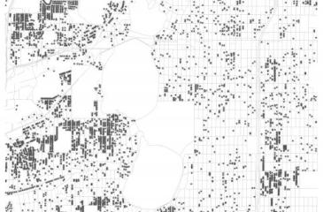
Geocoding with a latitude and longitude enables records to be placed as points on a map -- similar to putting pins on a paper map -- and analyzed with other spatial data. Now, thanks to a collaborative effort with the Minnesota Population Center, researchers can obtain geocoded data from:
- The electronic health records of more 2 million patients seen at Fairview and University of Minnesota Physicians, and who consented to share their de-identified information for research purposes. Data about patients (e.g., demographics, medical histories) as well as their hospital and clinic visits (e.g., diagnoses, procedures, medications, lab tests, visit location, and provider specialty) are securely housed in the University’s clinical data repository.
- Minnesota death certificate records issued from 2011 to present. CTSI’s death records database houses complete records for deceased individuals who were born in Minnesota, have died in Minnesota, or have ever had a permanent address in the state.
The ability to view location-based clusters creates new opportunities for social epidemiologists and health service researchers to study health disparities, healthcare access and provision, and many other health topics.
For example, investigators can use this data to graph precise clusters of chronic diseases or measure the distances that patients travel to their clinics or other locations. This could help researchers answer questions such as “is heart disease more common in the inner city or rural areas?” and “is distance to a grocery store a geo-determinant of type 2 diabetes?”. It also enables researchers to discover and study geographical clusters, such a rare form of cancer that’s heavily concentrated near a clean-up site.
Previously, the best way to cluster patients was by ZIP code. But this limited researchers trying to focus on a very specific location or an area that crosses ZIP code boundaries. ZIP code boundaries can also change over time, making direct comparisons difficult, unreliable, and less precise.
Researchers can request clinical and death record data – geocoded and otherwise – from CTSI’s Informatics Consulting Service.